

You can find on this page the Turkey population map to print and to download in PDF. The Turkey population density map presents the number of inhabitants in relation to the country size and the structure of the population of Turkey in Asia.

The Turkey population density map shows the number of inhabitants in relation to Turkey size. This demographic map of Turkey will allow you to know demography and structure of the population of Turkey in Asia. The Turkey density map is downloadable in PDF, printable and free.
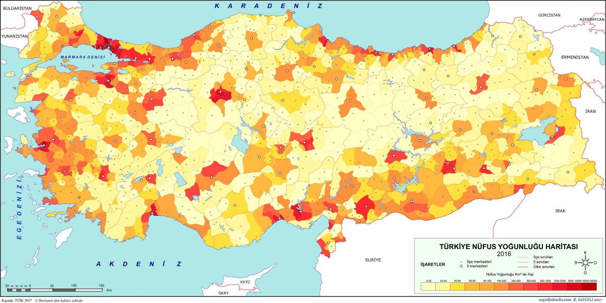
Turkey ranks number 17 in the list of countries (and dependencies) by population. The population density in Turkey is 110 per Km2 (284 people per mi2) as its mentioned in Turkey population density map. The total land area is 769,630 Km2 (297,156 sq. miles). 75.7 % of the population is urban (63,803,445 people in 2020). The median age in Turkey is 31.5 years.
Turkey current population density growth rate is 1.09%, which has been decreasing gradually every year. Turkey current population of 84.34 million is expected to peak at 97.96 million in 2059 and then decrease in the years following as you can see in Turkey population density map. By the end of the century, the population is expected to decline back to 86.61 million.
As of 2010, the population of Turkey is estimated to be 73.7 million with a growth rate of 1.21% per annum (2009 figure). The population is relatively young with 26.6% falling in the 0-14 age bracket as its shown in Turkey population density map. According to the OECD/World Bank population statistics in Turkey the population growth from 1990 to 2008 was 16 million and 29 %.